

INSPECTIONS
& MAPPING
The team at RECON Media provides professional drone inspection and mapping services that deliver accurate, high-resolution visual data for construction sites, commercial properties, utilities, and infrastructure projects. Whether you need progress documentation, roof inspections, or aerial site mapping, we offer safe, efficient, and cost-effective solutions using FAA-certified drone technology.
With over a decade of flight experience and advanced post-processing tools, we help you capture, analyze, and present your site data with confidence and clarity.
Our Inspection & Mapping Services
-
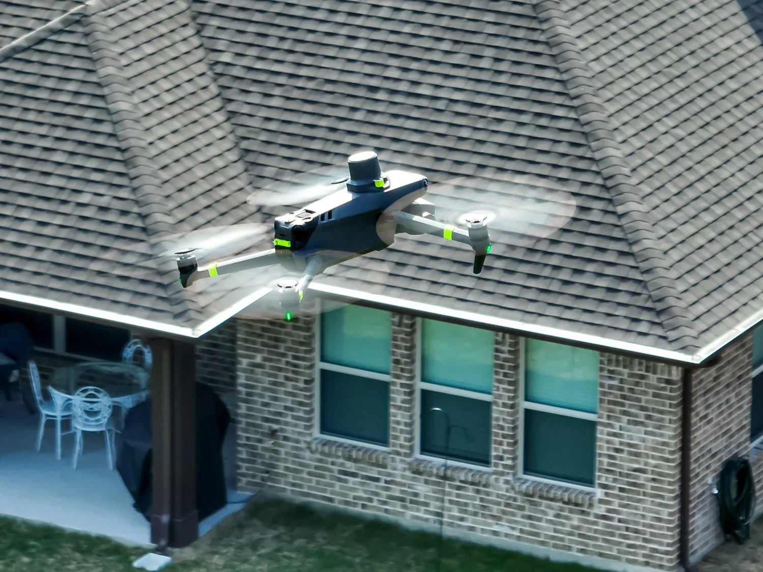
Roof & Structural Drone Inspections
High-resolution roof inspections using drones to identify damage, wear, or potential issues—without climbing ladders or renting lifts. Perfect for commercial buildings, schools, and large facilities.
-

Aerial Site Surveys & Property/Land Documentation
Wide-angle and detailed aerial surveys for large properties, industrial zones, farmland, or real estate developments. Delivered with geotagged images and map overlays. Capture clear, geo-referenced visuals of parcels, plots, or campuses—ideal for real estate developers, zoning reports, and pre-sale documentation.
-
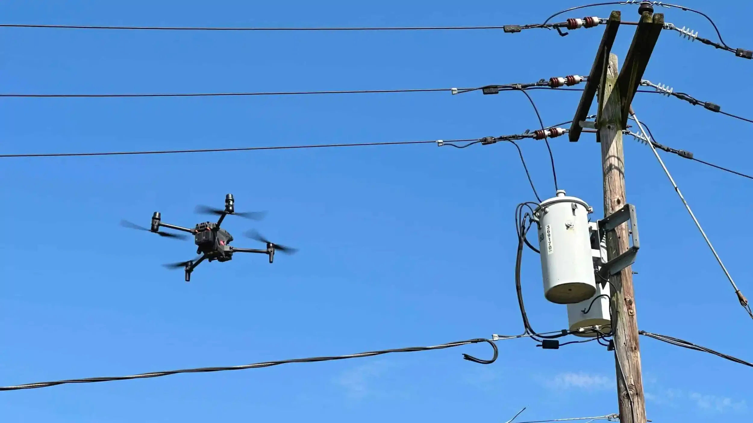
Utility & Infrastructure Inspections
Safe and efficient drone inspections for power lines, cell towers, rooftop HVAC units, and solar arrays, reducing the need for manual access or scaffolding.
-
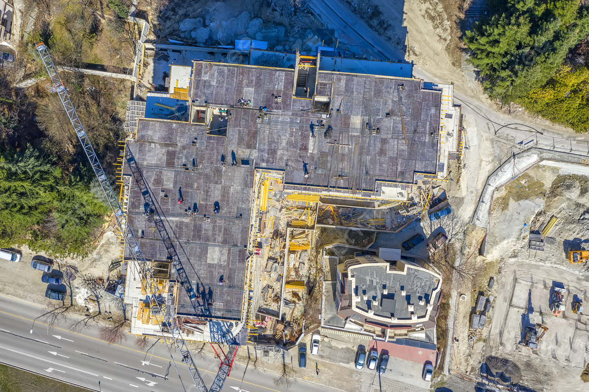
Construction Site Progress Mapping
Track every stage of your project with consistent aerial documentation. Ideal for general contractors and developers who need ongoing visuals for internal updates, stakeholder reporting, or marketing.
-
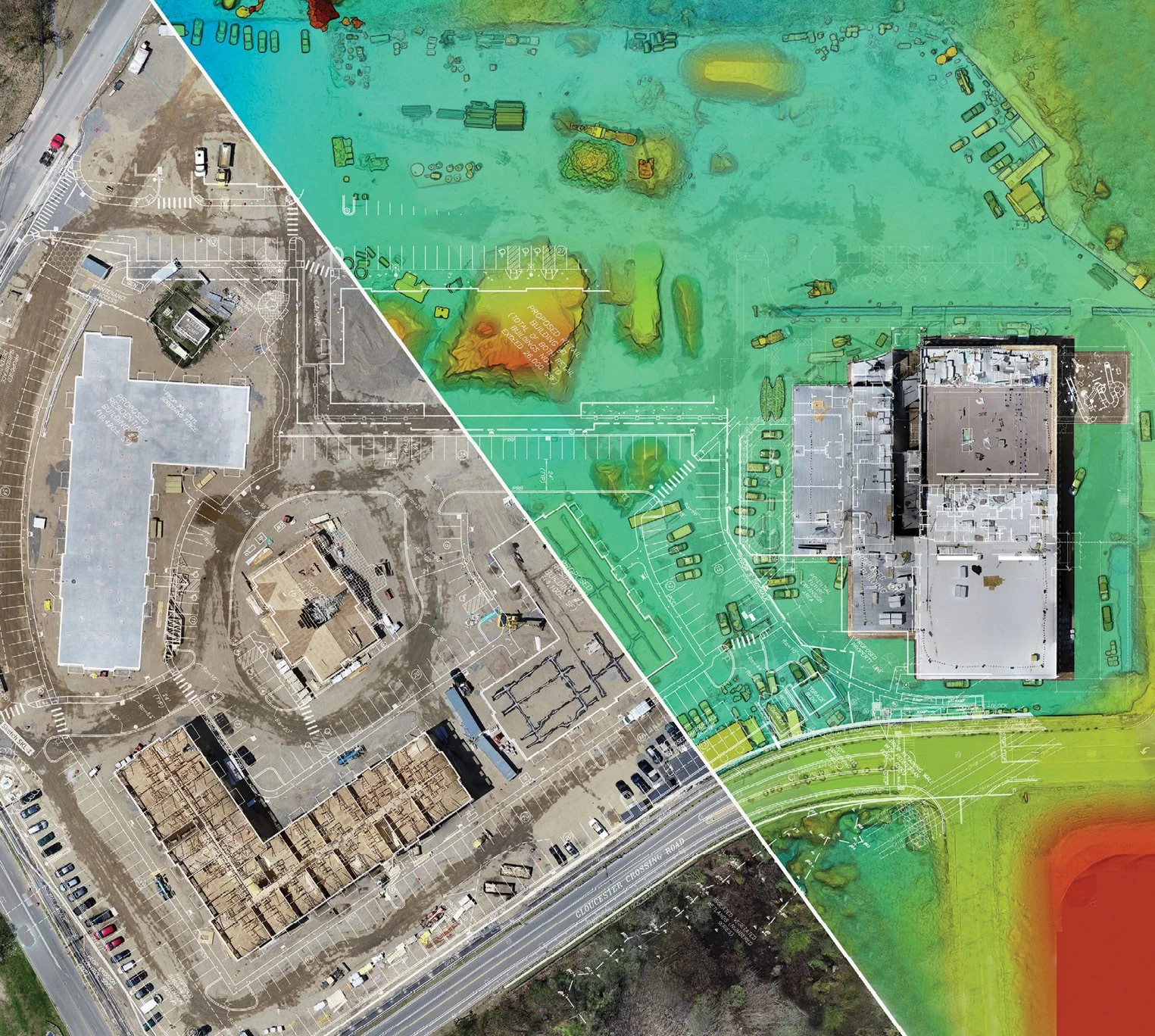
Orthomosaic Mapping & 2D Site Models
Generate precise orthomosaic maps and top-down aerial images stitched from dozens of high-resolution photos—perfect for project planning, site layout, and land surveying visuals.
-
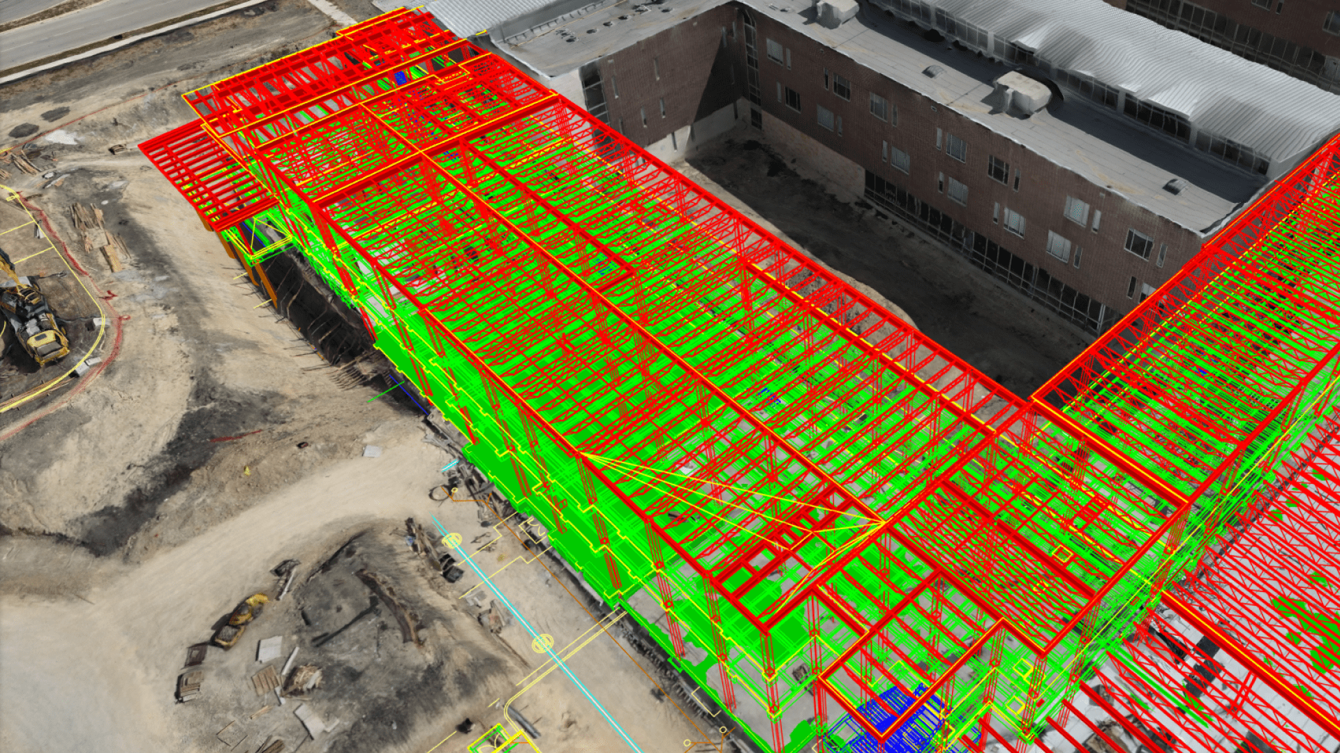
3D Mapping & Modeling
Capture your job site or property in immersive 3D using photogrammetry. Great for presentations, asset management, or pre-construction visualizations.